Geography of
OREGON
The physical geography:
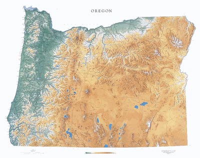
Physical geography has to do with the way the land looks and Oregon is a very diverse and unique state in way it looks. There are mountains, beaches, desert, a gorge, a valley and much more. Take a look at the maps below. Then see if you can answer some questions.
Questions:
1. In your opinion, which map depicts the physical geography of Oregon the best?
2. How many mountain ranges do you see?
3. On the second map, do the green markings mean higher elevations?
4. Use either map, find the area you live in. How do you think it is different from someone whose home is the coast? The mountains?
Climate:
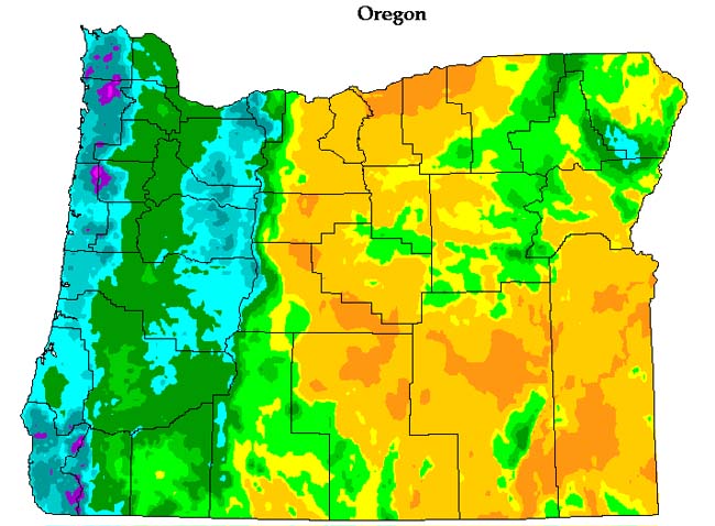
Oregon also has a variety of climates. Climate has to do with the weather that usually occurs in a certain area. Below are three maps. The first one shows the average temperature for January. The second map shows the average temperature for July. The third map shows the average rainfall in the different areas.
Average January temperatures:
dark blue: below 24; light blue: 24-32; white: 32-40; cream: above 40 (all degree Fahrenheit)
Average July temperatures:
dark red: above 72; light red: 68-72; tan: 64-68; cream: below 64 (all degree Fahrenheit)
Average Precipitation: