Road Trip
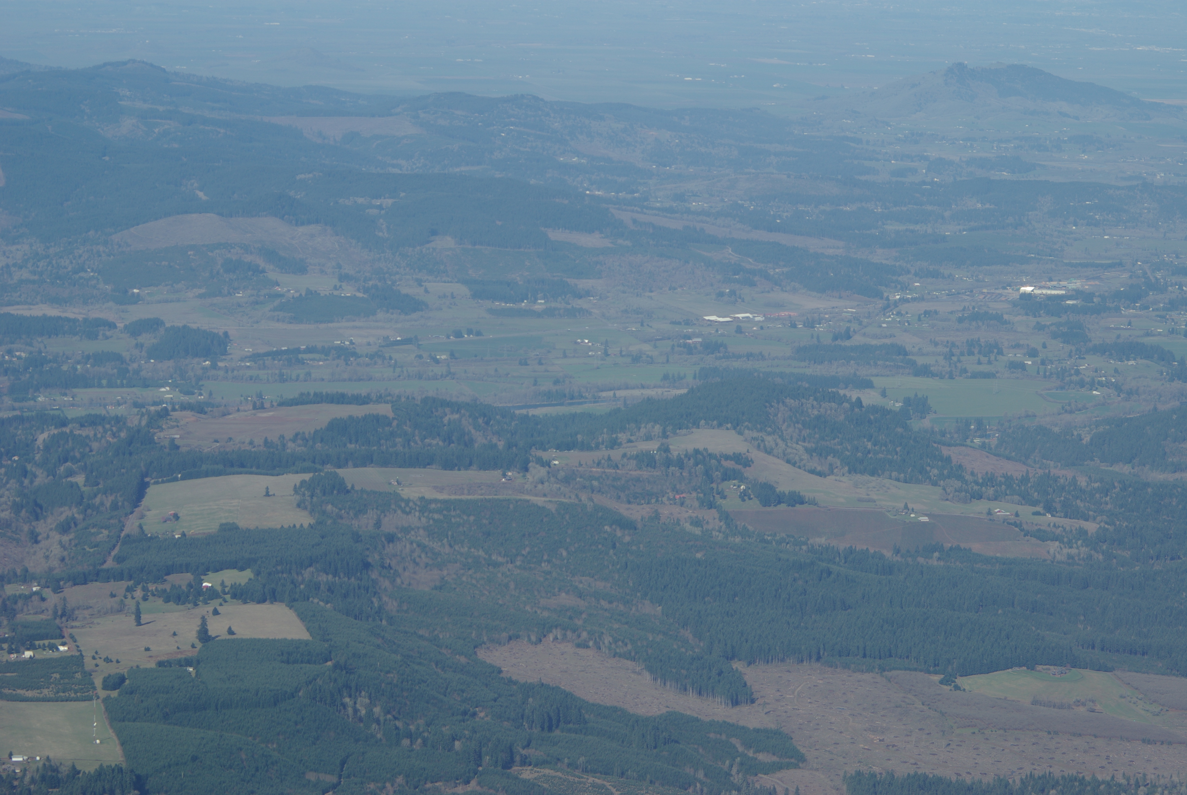
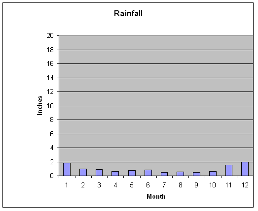
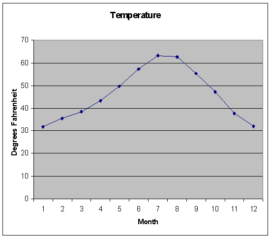
Below are photographs of locations from the Oregon Coast to central Oregon. These photos were taken in early April. Remember, your lab instructions say you took the road trip in the winter. What would the weather be like in December or January??
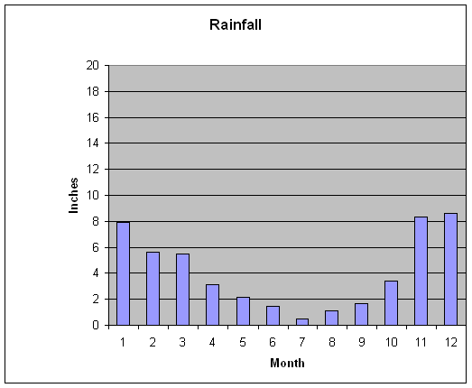
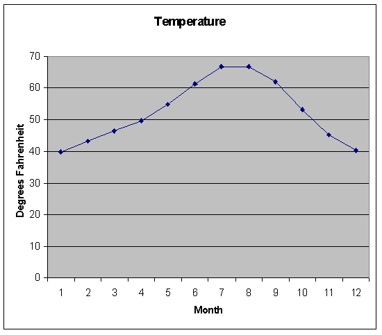
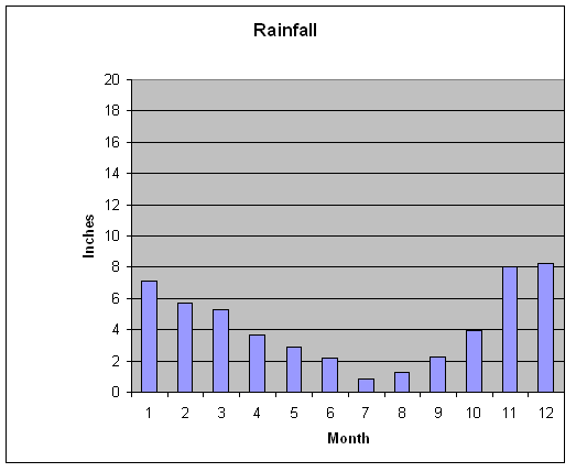
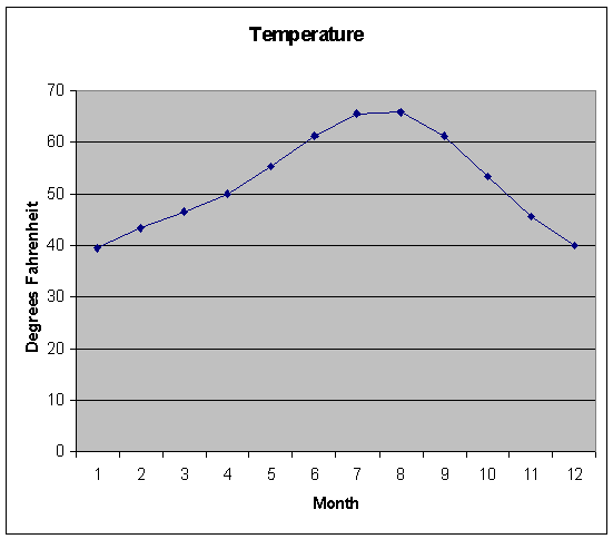
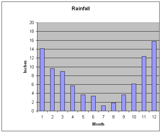
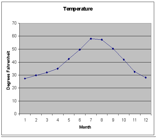
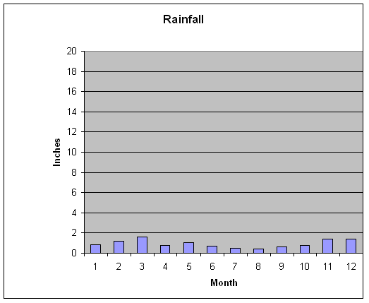
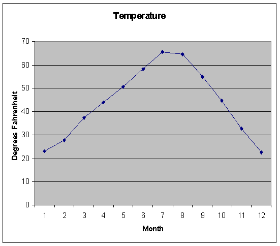
| location | photo of area | vegetation | Rainfall | Precipitation |
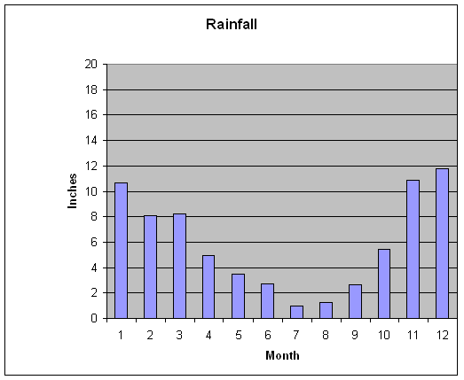
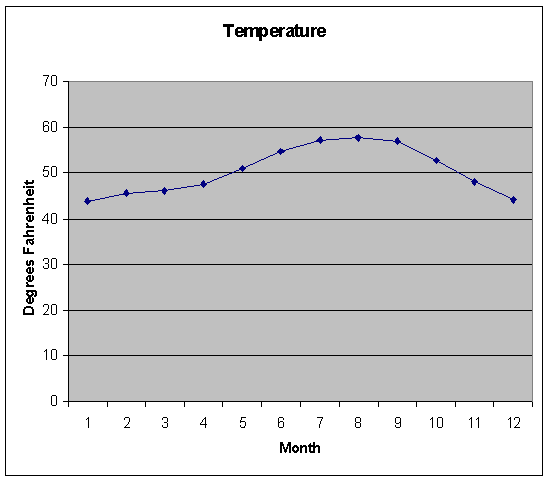
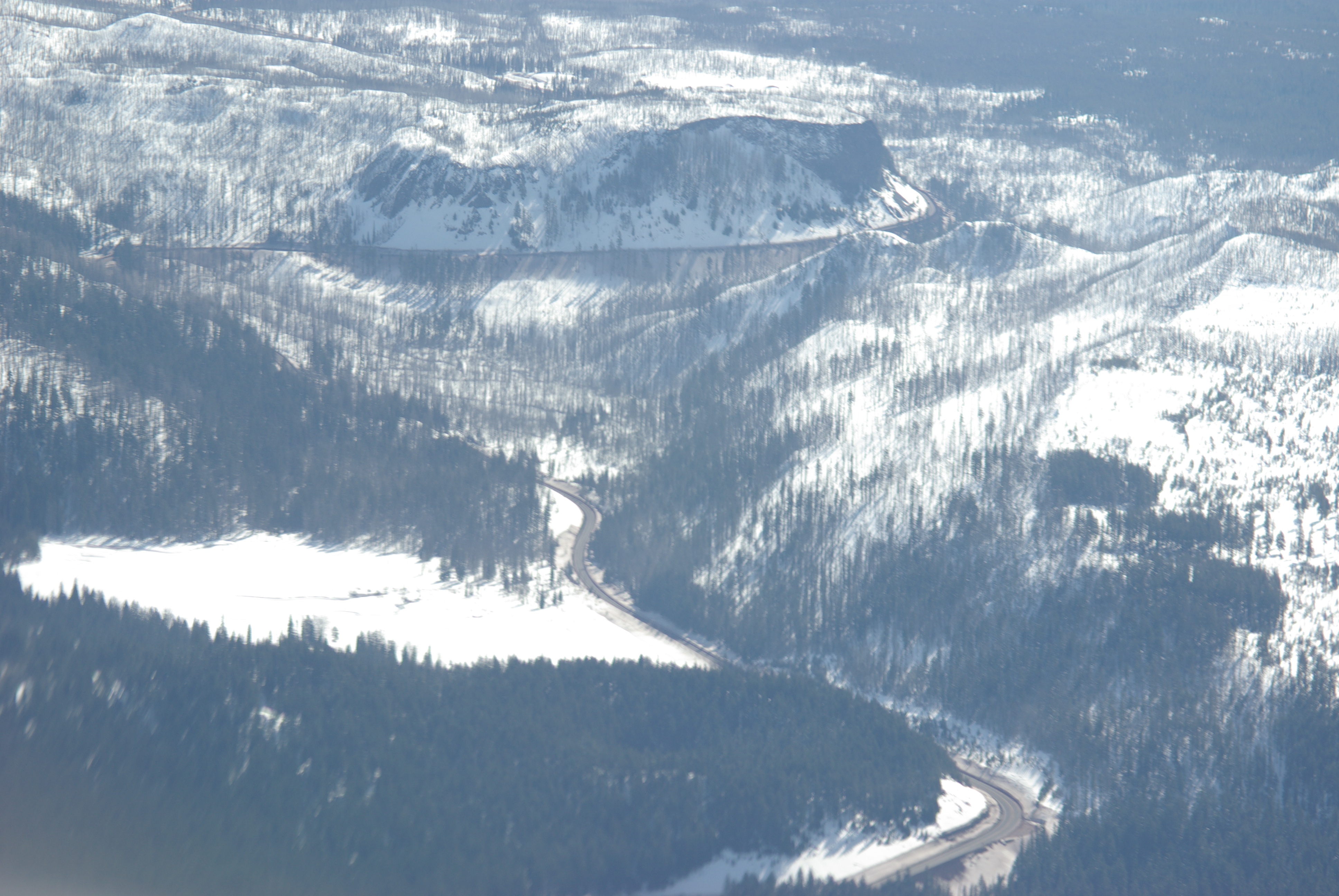
| Newport Elevation 140 msl |
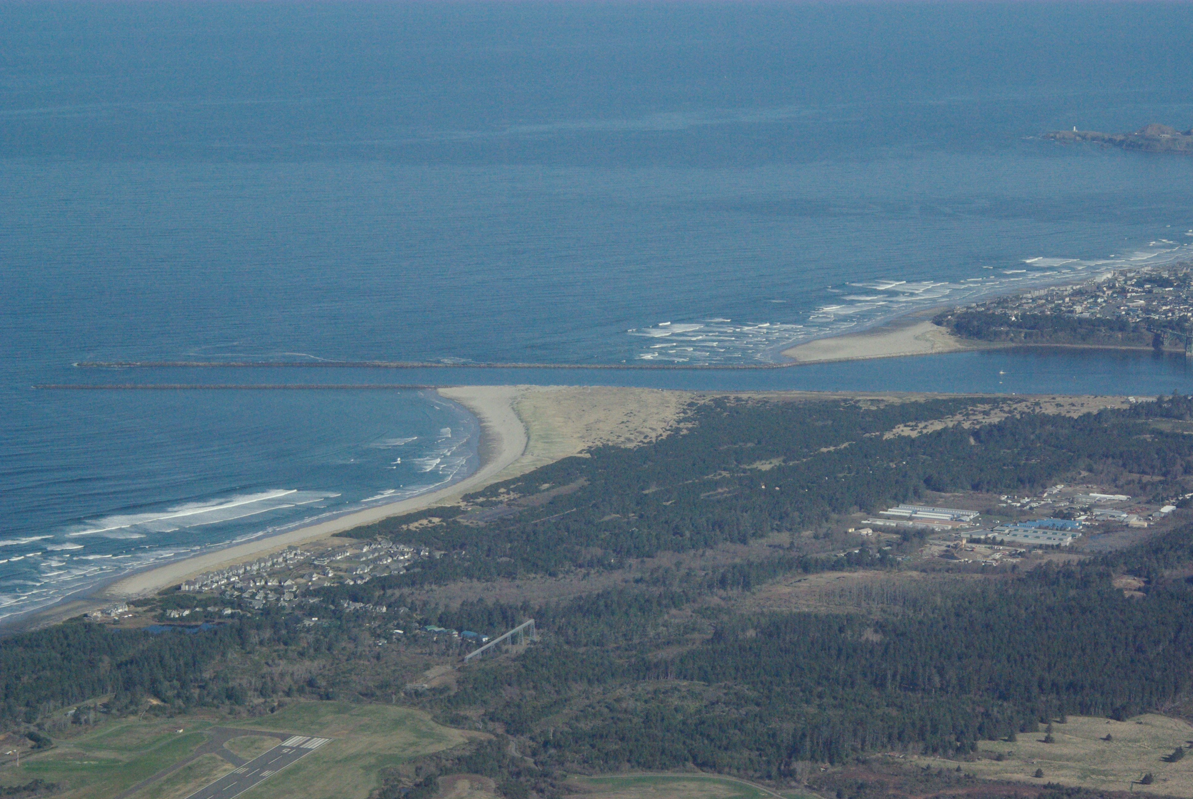 |
douglas fir, western red cedar, myrtle, dogwood, maple |
|
|
| Corvallis Elevation 240 msl |
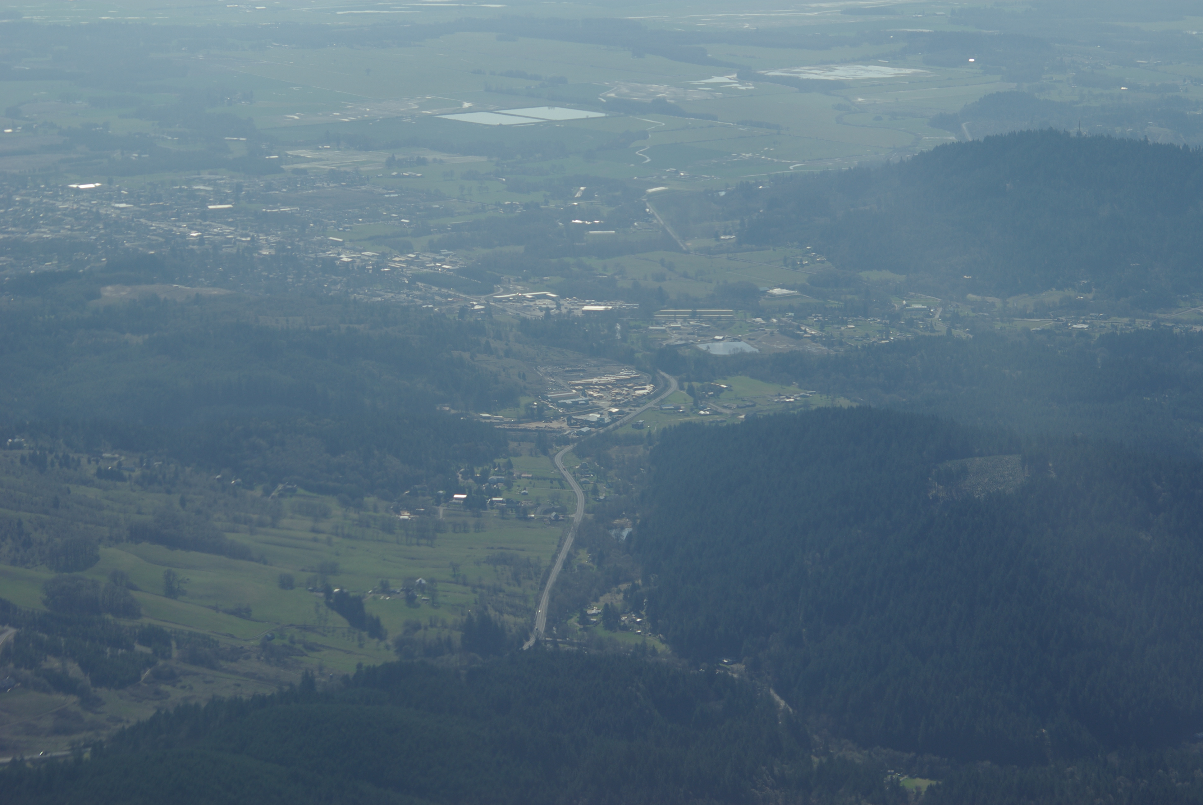 |
douglas fir, western red cedar, maple, oak; giving way to grasslands, shrubs and agricultural fields |
|
|
| Sweet Home Elevation 400 msl |
 |
douglas fir, oak; after valley floor of agricultural fields |
|
|
| Santiam Pass Elevation 4750 msl |
 |
douglas fir, ponderosa pines, larch |
|
|
| Bend Elevation 3660 mls |
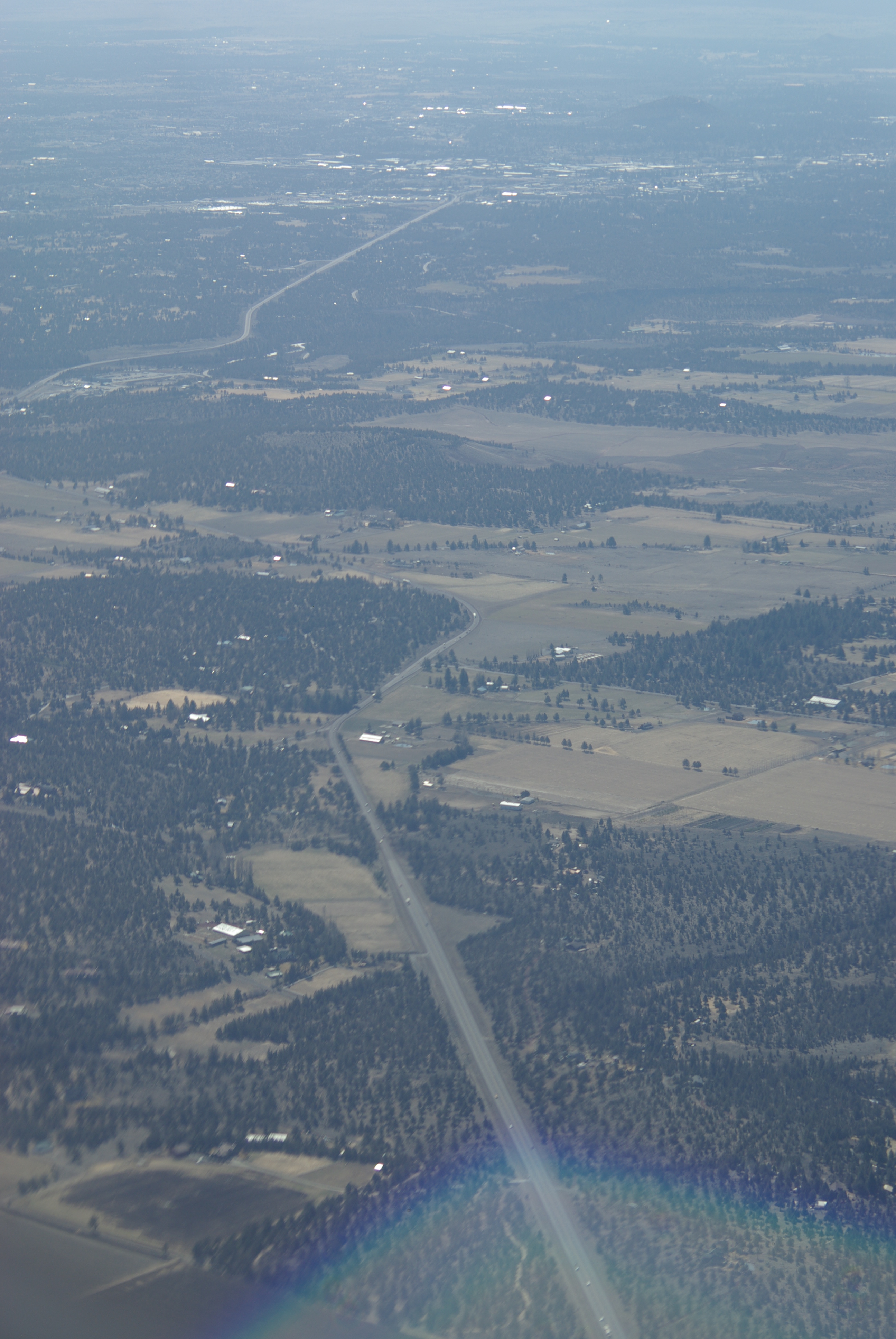 |
ponderosa pine, piñon pine, sagebrush, grasslands |
|
|
| Burns Elevation 4140 msl |
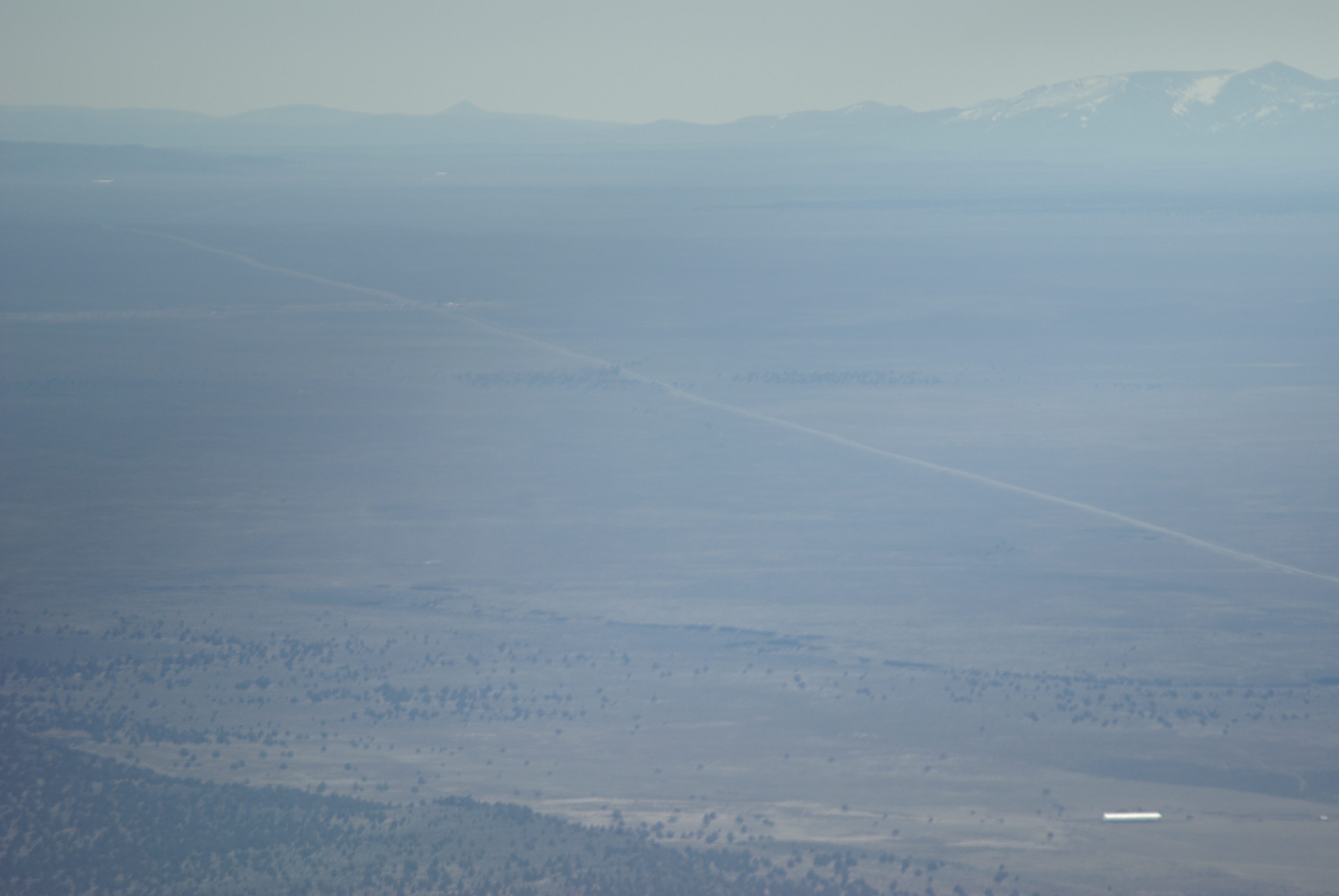 |
sagebrush, grasslands, piñon pine |
|
|
| Ontario
|
no photo | agricultural fields, sagebrush, grasslands | ||
| Boise
|
no photo | agricultural fields, sagebrush, grasslands |